
Por favor, use este identificador para citar o enlazar este ítem:
http://biblioteca.cehum.org/handle/123456789/45Registro completo de metadatos
| Campo DC | Valor | Lengua/Idioma |
|---|---|---|
| dc.contributor.author | Corporación Nacional Forestal | - |
| dc.date.accessioned | 2018-04-21T00:41:30Z | - |
| dc.date.available | 2018-04-21T00:41:30Z | - |
| dc.date.issued | 2010 | - |
| dc.identifier.uri | http://biblioteca.cehum.org/handle/123456789/45 | - |
| dc.description | Coordenadas geográficas: Latitud -23°13’0" Longitud -67°30′ 0″ | es_ES |
| dc.language.iso | es | es_ES |
| dc.publisher | Corporación Nacional Forestal | es_ES |
| dc.subject | Chile | es_ES |
| dc.subject | Región II | es_ES |
| dc.subject | Ramsar | es_ES |
| dc.subject | Mapa | es_ES |
| dc.subject | Cartografía | es_ES |
| dc.subject | Parque Nacional | es_ES |
| dc.subject | Humedal | es_ES |
| dc.title | Sitio Ramsar Salar de Pujsa | es_ES |
| dc.type | Map | es_ES |
| Aparece en las colecciones: | Informes | |
Ficheros en este ítem:
| Fichero | Descripción | Tamaño | Formato | |
|---|---|---|---|---|
| Conaf. Sitio Ramsar, Salar de Pujsa.JPG | 3.28 MB | JPEG | 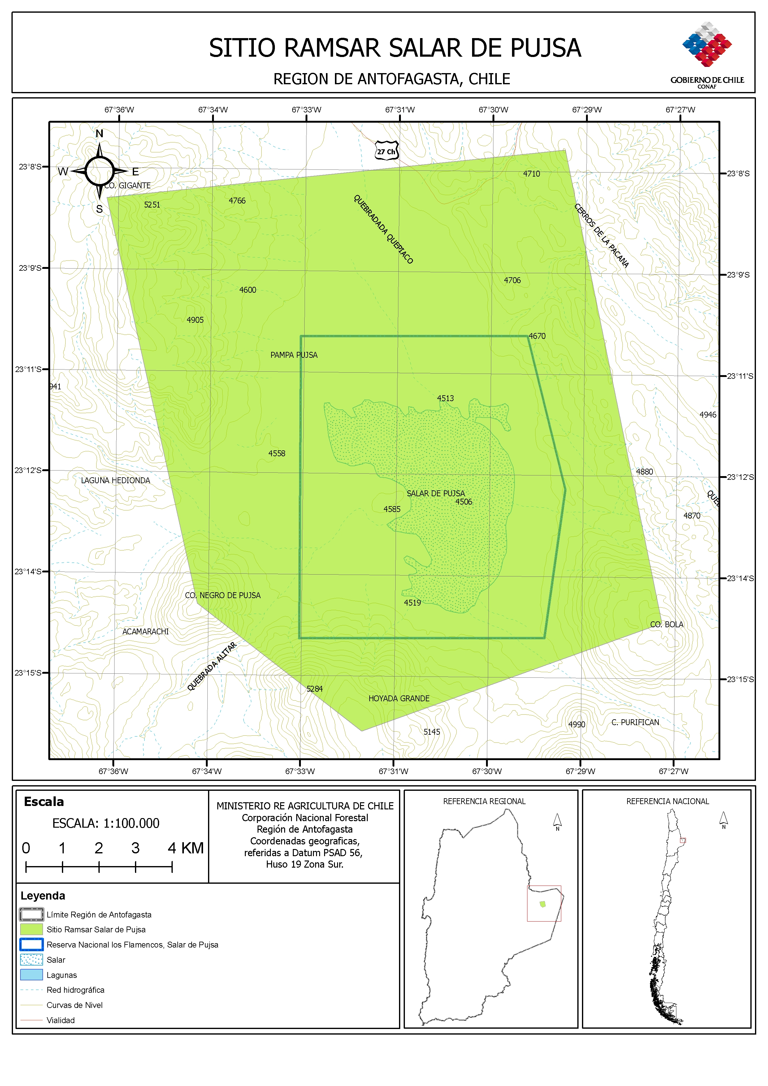 Visualizar/Abrir |